Using Drone Technology To Examine An Earth Fissure
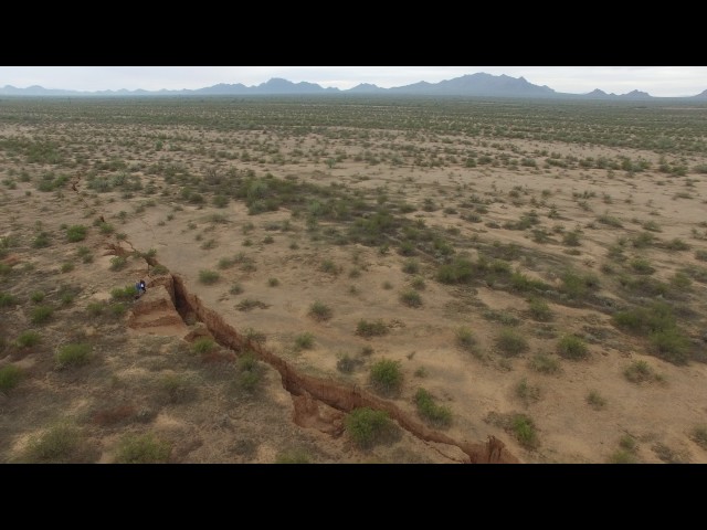
Drone visual of a fresh earth fissure in the Tator Hills area, southern Pinal County. AZGS is experimenting with drone technology as a tool for mapping fissures and other surface features, e.g. landslide masses. Drone operator B. Gootee (AZGS).
What’s the depth of this fissure? Anyone know?
Maybe we will get #CalExit after all!
Its all Trump and Obamas fault—– Get it? FAULT—-harharhar. So when ya gonna talk about the various celestial bodies approaching?
It is the start of the New Grand Canyon..
So this is the “Trump Effect” – shitty weather, world-wide protests, and the earth splitting in half.
Jesus christ quit flying in circles
Fault line?
Скоро должен явиться припозднившийся с 1999 г. “король ужаса” – Ангол Муа !
whyyy,…that looks like my , 3rd wife’s ????
How did you Find it in the middle of nowhere?
Probably Tripods moving under the soil.
I have a feeling that this and other large surface cracks are being caused by the changing shape of our planet that is being caused by shifting weight distribution due to melting poles and possible pole shifts. Like making a snow ball when you change the shape of it in one location the other locations relieve the stress with cracks
Just another grand canyon forming.
Beautiful footage
Only a lava dome expanding below in an already volcanic area.
Bugs Bunny and Daffy Duck on their way to Pismo Beach!
пизда сша пока короче все в трещину
the end, NIBIRU
is there any indication of any tactonic plates there?
the globalist fissure. MAGA
no hay ubicacion geografica del lugar
None tree!
пиздос вам америкосы)
Don’t panic. Even low magnitude fault movement close to the surface can create features like this. You want to see some decent ruptures? Come to NZ.
http://www.radionz.co.nz/news/national/319798/nine-faults-ruptured-in-kaikoura-quake
Доиграется америка, провалится в яму.
The effects of living on a round planet.
I was too distracted by the vast open desert and scenery to care about the fault.
Could you please insert the google maps location of that location? Thank you very much!
How did you all get out there? Was is a long walk or did you hide your motorbikes in a bush somewhere?